Postcode Sector Map - (S19) - Highlands & Islands - Wall Map-Plastic Coated
XYZ Maps
Description
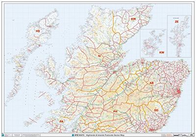
This Highlands & Islands Sector Wall Map shows detailed Postcode Sector Boundaries (IV1 1, IV1 2) on a Comprehensive Background A0 Size - 1189mm x 841mm Plastic Coated waterproof / wipeable Read more
GTIN
5060688685970
Offered by
XYZ Maps
Save product
Compare Product
Price history